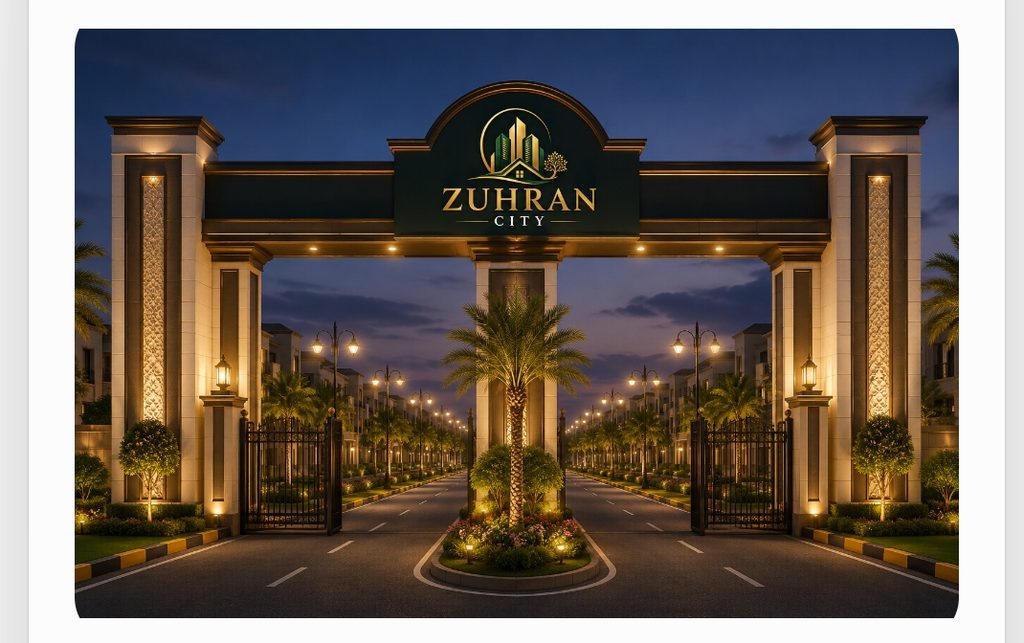
A Planned Residential Community Project by Mayo Developers
Zuhran City is a residential development project by Mayo Developers, a company with extensive experience in the real estate and development sector. The project is planned with a focus on providing residents with a comfortable living environment, essential community facilities, convenient access, and long-term development potential.
Mayo Developers aims to develop Zuhran City as a well-organized residential community where modern infrastructure, essential utilities, green spaces, and community facilities are brought together in one location.
Prime Location and Accessibility
One of the important values of Zuhran City is its location. The project is situated near major and important roads, providing convenient connectivity to surrounding areas and making travel and access easier for residents, visitors, and property owners.
Its proximity to main roads can provide several practical advantages, including:
- Convenient access to the surrounding areas
- Easier transportation for residents
- Better connectivity with important roads and routes
- Accessibility for families, visitors, and businesses
- Potential convenience for future commercial and residential development
Good road connectivity is an important consideration when evaluating a residential development because accessibility can contribute to the overall convenience and usability of a community.
Electricity and Utility Infrastructure
Zuhran City is planned to provide essential infrastructure and utility facilities for residents. Electricity availability is an important part of the development plan, supporting the everyday needs of homes and community facilities.
The project also considers modern and alternative energy solutions, including the planned solar plant setup. The use of solar energy can support a more sustainable approach to power generation and can contribute to the project’s long-term energy strategy.
Solar Plant Setup
A notable planned feature of Zuhran City is its solar plant system.
The inclusion of solar energy reflects the growing importance of renewable energy in modern residential developments. A properly planned solar power system can help support community infrastructure and provide an additional energy source.
The solar plant concept can offer potential benefits such as:
- Supporting renewable energy use
- Reducing dependence on conventional energy sources
- Providing power support for selected community facilities
- Promoting environmentally responsible development
- Supporting the project’s long-term sustainability goals
The exact capacity, installation, distribution, and operational arrangements of the solar plant should be confirmed according to the project’s approved development and utility plans.
Mosque and Community Facilities
Zuhran City is planned to include a mosque for residents and the surrounding community. A mosque within a residential community provides convenient access to a place of worship and can also serve as an important community gathering space.
The development’s community-oriented planning is intended to make everyday life more convenient for families living within the project.
Water Plant and Water Facilities
Access to a reliable water supply is essential for any residential community. Zuhran City is planned to include a water plant/water supply facility to support the water requirements of the development.
The water infrastructure is intended to contribute to a more organized residential environment by supporting essential household and community needs.
The final specifications, capacity, filtration arrangements, and operational procedures should be provided according to the project’s engineering and approved infrastructure plans.
Parks and Green Spaces
Zuhran City also places importance on parks and green spaces. Planned parks can provide residents with areas for relaxation, walking, family activities, and outdoor recreation.
Green spaces can contribute to the overall appearance and livability of a residential community while providing families and children with recreational areas close to their homes.
Possible community landscaping features may include:
- Family parks
- Children’s recreational areas
- Green belts
- Walking areas
- Landscaped open spaces
- Plantation and greenery
Residential Environment
The vision of Zuhran City is to create a residential environment where families can enjoy essential facilities within a planned community.
The combination of accessibility, utilities, community facilities, green spaces, and modern energy solutions is intended to create a comfortable and organized living environment.
The project can be particularly relevant for people looking for a residential location where important facilities are planned within or around the community rather than requiring residents to travel long distances for every basic need.
Development by Mayo Developers
Mayo Developers is responsible for the development of Zuhran City and brings experience in the real estate and development field.
The developer’s approach focuses on combining property development with infrastructure, accessibility, community facilities, and modern requirements.
For a successful residential project, development is not limited to plots and roads. Infrastructure such as electricity, water, drainage, community facilities, green spaces, and accessibility are also important components of a functional residential community.
Key Planned Features of Zuhran City
Zuhran City is planned around several important features:
- Strategic accessibility near major roads
- Residential plots and community planning
- Electricity infrastructure
- Mosque
- Water plant/water supply facilities
- Parks and green spaces
- Solar plant setup
- Community-oriented development
- Modern infrastructure planning
- Family-friendly residential environment
- Convenient connectivity with surrounding areas
Why Location Matters
Location is one of the most important considerations in real estate. A residential project located close to major roads can provide greater convenience for daily travel and connectivity.
Zuhran City’s proximity to important roads is therefore one of the project’s key location features. As surrounding infrastructure and development progress, accessibility can become increasingly important for residents and property owners.
However, buyers should always independently verify the project’s exact location, approved layout, development status, utility connections, and relevant legal documentation before making a property purchase.
A Vision for the Future
Zuhran City is being developed with a vision of creating more than just a collection of residential plots. The project aims to establish a planned residential community with essential facilities, infrastructure, green areas, and modern energy solutions.
With planned electricity, water facilities, a mosque, parks, solar energy infrastructure, and convenient access to major roads, Zuhran City is designed around the everyday requirements of a modern residential community.
Conclusion
Zuhran City, a project of Mayo Developers, is planned as a residential community focused on accessibility, infrastructure, essential facilities, sustainability, and family living.
Its location near major roads, together with planned electricity, mosque, water plant, parks, and solar plant facilities, forms the foundation of its development vision.
Mayo Developers’ objective is to develop Zuhran City into an organized and comfortable residential community where residents can benefit from convenient connectivity and essential facilities while enjoying a planned and modern living environment.
Zuhran City — planned for connectivity, community, comfort, and a modern residential lifestyle.
Zuhran City Map Details
A Planned Residential Community by Mayo Developers
The Zuhran City map represents the overall planning and development vision of this residential project by Mayo Developers. The map is designed to organize residential plots, roads, public facilities, green spaces, and essential infrastructure in a systematic manner.
A well-planned housing map is important because it gives buyers and residents a clear understanding of how the community is arranged, where plots are located, how roads connect different areas, and where essential facilities are planned.
1. Overall Map Planning
The Zuhran City map is planned to provide an organized residential environment with properly arranged plots, roads, open spaces, and community facilities.
The map is intended to make it easier for residents to access different parts of the society while maintaining a practical layout for residential development.
The planning concept includes:
- Residential plot areas
- Internal roads and streets
- Main access roads
- Parks and green areas
- Mosque
- Water plant
- Electricity infrastructure
- Solar plant area
- Public and community facilities
- Open spaces
- Future development areas
The final location and dimensions of individual facilities should always be checked against the latest approved map issued by the developer or relevant authority.
2. Main Entrance and Access Points
The entrance of a residential society is one of the most important features shown on its map. The Zuhran City map highlights the project’s accessibility and connection with surrounding roads.
The project is positioned near major and important roads, providing access to the surrounding areas.
The entrance and access-road planning is intended to provide:
- Easy entry and exit
- Convenient access for residents
- Better visitor movement
- Connection with major surrounding roads
- Easier transportation
- Improved accessibility for future development
A properly planned entrance can also help organize traffic movement within the residential community.
3. Main Roads
The main roads shown in the Zuhran City map are intended to provide primary movement through the project.
These roads can connect the main entrance with different sections of the society and provide access to residential streets and community facilities.
Main roads are particularly important because they can help:
- Connect different blocks or sectors
- Provide access to residential plots
- Improve traffic flow
- Connect important facilities
- Make navigation easier
- Support future development
The actual road widths should be verified from the official project map.
4. Internal Streets
In addition to main roads, the map includes a network of internal streets designed to provide access to individual residential plots.
Internal streets help create an organized neighborhood structure and allow residents to reach their homes conveniently.
The layout of internal streets is an important consideration for buyers because it determines:
- Plot accessibility
- Corner and facing plots
- Street connectivity
- Traffic movement
- Distance from parks and facilities
- Overall neighborhood arrangement
5. Residential Plot Planning
The main purpose of the Zuhran City map is to organize the residential plots within a structured community.
Residential plots are arranged according to the project’s planned layout, with roads and streets providing access to individual properties.
Depending on the official map, buyers may identify different plot locations based on:
- Plot number
- Plot size
- Street location
- Corner position
- Road-facing position
- Park-facing position
- Main-road location
- Nearby community facilities
Buyers should verify the exact plot number, dimensions, location, and category directly from the official map and allotment documentation.
6. Corner Plots
The map can also help identify corner plots, which are plots located at the intersection of two streets or roads.
Corner plots may have different characteristics from standard plots because of their position and accessibility.
When considering a corner plot, buyers should check the official map to confirm:
- Exact corner location
- Road widths
- Plot dimensions
- Building regulations
- Applicable development charges
- Any restrictions associated with the plot
7. Main Road-Facing Plots
Plots located along major internal roads can be identified through the map.
A main-road-facing plot may provide convenient access and visibility compared with a plot located deeper inside the residential area. However, the characteristics of each plot depend on the actual road layout, surrounding development, and applicable planning regulations.
The map allows buyers to compare different locations before selecting a plot.
8. Park-Facing Plots
One of the planned features of Zuhran City is the provision of parks and green spaces.
The map is useful for identifying residential plots located near or facing planned parks.
Park-facing locations can provide residents with convenient access to recreational and green areas. Families can benefit from nearby open spaces for walking, relaxation, and children’s activities.
The exact park-facing plots should be confirmed from the latest official map.
9. Mosque Location
A mosque is planned as part of the community facilities of Zuhran City.
The mosque’s location on the map is important because it shows residents how easily they can access this community facility from different residential areas.
A centrally accessible mosque can support the community’s daily religious and social needs.
The exact mosque location and dimensions should be verified from the developer’s current map.
10. Parks and Green Areas
The Zuhran City map incorporates planned parks and green spaces as part of the residential environment.
Green spaces can provide:
- Family recreation
- Children’s play areas
- Walking spaces
- Relaxation areas
- Community interaction
- Improved landscaping
The placement of parks within a residential map can also help create more open and family-oriented neighborhoods.
11. Water Plant
The map also considers space for a water plant/water supply facility.
A dedicated water facility is an important part of residential infrastructure because water is an essential requirement for homes and community facilities.
The planned water infrastructure can support the development’s water-supply requirements.
The final water plant location, capacity, filtration system, and operational arrangements should be confirmed from the developer’s engineering and infrastructure plans.
12. Electricity Infrastructure
Electricity infrastructure is another important component of the Zuhran City development plan.
The map and infrastructure planning are intended to accommodate the requirements necessary for supplying electricity to residential areas and community facilities.
Proper utility planning can support the long-term functionality of the residential community.
Details regarding electricity connections, distribution infrastructure, transformers, and related facilities should be confirmed according to the latest approved development plan.
13. Solar Plant Area
A particularly notable feature planned for Zuhran City is a solar plant setup.
The inclusion of a solar plant reflects an approach toward incorporating renewable energy into the development.
The solar plant area can be planned to support selected community infrastructure and energy requirements.
Potential benefits of incorporating solar energy include:
- Renewable energy generation
- Additional energy support
- Sustainable development
- Reduced dependence on conventional energy sources
- Support for community facilities
The exact location, capacity, ownership, operation, and electricity distribution arrangements of the solar plant should be confirmed from the project’s official documentation.
14. Open Spaces
Open spaces are an important component of a residential map. They can provide room for landscaping, community activities, recreational purposes, and future planning requirements.
The Zuhran City map is designed with consideration for residential development as well as community-oriented spaces.
15. Road Connectivity Between Facilities
A good residential map should not only arrange plots; it should also provide convenient connectivity between important facilities.
The Zuhran City planning concept connects residential areas with facilities such as:
Residential Plots → Internal Streets → Main Roads → Parks → Mosque → Water Facilities → Utility Infrastructure
This connectivity can make the community easier to navigate and support the everyday needs of residents.
16. Map-Based Plot Selection
The Zuhran City map can help potential buyers compare different plot locations before making a decision.
A buyer should consider:
- Plot number
- Plot size
- Street width
- Distance from the main entrance
- Distance from major roads
- Park proximity
- Mosque proximity
- Electricity infrastructure
- Water infrastructure
- Future development around the plot
- Corner or non-corner position
- Main-road or street-facing position
This approach allows buyers to evaluate a plot based on its actual position within the overall community rather than considering the plot in isolation.
17. Future Development Planning
The Zuhran City map is also important from a long-term development perspective.
As development progresses, roads, utilities, parks, community facilities, and other infrastructure can gradually create a more complete residential environment.
Mayo Developers’ development vision is to establish Zuhran City as a planned community where residential development is supported by essential infrastructure and facilities.
Any future facilities, extensions, or changes should be verified against officially updated maps and development plans.
Key Features Shown or Planned in the Zuhran City Map
| Feature | Purpose |
|---|---|
| Main Entrance | Entry and exit to the community |
| Main Roads | Primary movement and connectivity |
| Internal Streets | Access to residential plots |
| Residential Plots | Housing and property development |
| Parks | Recreation and green space |
| Mosque | Community religious facility |
| Water Plant | Water-supply infrastructure |
| Electricity Infrastructure | Residential and community power requirements |
| Solar Plant | Renewable-energy infrastructure |
| Open Spaces | Landscaping and community planning |
| Connecting Roads | Movement between different areas |
Why the Zuhran City Map Matters
The map gives potential buyers a visual understanding of the complete development rather than focusing only on individual plots.
It helps answer important questions such as:
- Where is my plot located?
- Which road provides access to my plot?
- How close is the plot to the main entrance?
- Is the plot near a park?
- Where is the mosque?
- Where is the water plant?
- Where is the solar plant?
- How are the internal streets connected?
- What facilities are planned around the residential area?
- What areas may be developed in the future?
Conclusion
The Zuhran City map by Mayo Developers is designed around the concept of an organized residential community with residential plots, road connectivity, parks, a mosque, water infrastructure, electricity facilities, and a planned solar plant.
Its proximity to major roads adds an important accessibility component to the overall development concept, while the planned community facilities are intended to support comfortable family living.
For prospective buyers, the official and latest map should be considered the primary reference for plot numbers, dimensions, road widths, facility locations, block boundaries, development status, and approved land-use details.
Zuhran City — a planned community designed around connectivity, residential living, essential facilities, green spaces, and modern infrastructure.
Invest in Zuhran City — Build Toward Your Future
Investing in Zuhran City can be an important step toward planning for your future.
Zuhran City, a residential project of Mayo Developers, is planned with a focus on accessibility, infrastructure, community facilities, and long-term residential development. Its location near major and important roads, along with planned facilities such as electricity, a mosque, water plant, parks, and a solar plant setup, adds value to the overall development vision.
Real estate investment is often considered a long-term opportunity, and choosing a project with planned infrastructure and convenient connectivity can be an important part of that decision.
Why Consider Zuhran City?
- Prime connectivity near major roads
- Planned residential community
- Electricity infrastructure
- Water plant and water-supply facilities
- Mosque for the community
- Parks and green spaces
- Planned solar plant setup
- Organized road and street network
- Development by Mayo Developers
- Potential for long-term residential and property use
Plan Your Future with Zuhran City
A property investment is not only about owning land—it can also be about planning where you and your family may live and building an asset for the future.
Zuhran City by Mayo Developers is planned to bring residential development, essential facilities, accessibility, and modern infrastructure together in one community.
Choose your plot. Plan your future. Build your vision with Zuhran City.
Investment decisions should be based on your own financial circumstances and verification of the project’s legal approvals, development status, ownership documents, and official map.
Zuhran City — Easy Investment on Installments
Make your dream of owning a plot easier with the Zuhran City installment plan.
Zuhran City, a residential project by Mayo Developers, offers an installment-based investment approach designed to make plot ownership more accessible and manageable for a wider range of buyers.
Instead of paying the complete amount at once, an installment plan can allow you to spread payments over an agreed period, making it easier to plan your finances while working toward property ownership.
Why Choose an Installment Plan?
- Easy and manageable payments
- Affordable investment approach
- Flexible payment planning
- Opportunity to secure a residential plot
- Planned residential community
- Located near major and important roads
- Planned electricity and water facilities
- Mosque and parks
- Planned solar plant setup
- Development by Mayo Developers
Start Small — Plan for the Future
You don’t necessarily need a large amount of money available at once to start planning for property ownership. With a suitable installment schedule, you can manage your payments over time according to the agreed terms.
Zuhran City makes property ownership more accessible through an easy installment-based investment plan.
Invest Today, Plan Tomorrow
Your future begins with a plan. Zuhran City by Mayo Developers brings together residential plots, planned infrastructure, community facilities, and an installment-based payment option.
Book your plot today and take a step toward your future.
Installment amounts, payment duration, booking requirements, and other terms should be confirmed from the official Zuhran City payment plan and documentation.
Purchase Property in Zuhran City
Ready to take the next step toward owning property in Zuhran City?
Contact the Zuhran City sales team on WhatsApp for information about available plots, booking details, installment plans, prices, and the latest project updates.
📱 WhatsApp: +92 311 7390432
Message us today to learn more about Zuhran City and available property options.